Lake Prespa From Ohrid: Three Countries, One Quiet Lake
Lake Prespa sits on the far side of the Galicica ridge from Ohrid, roughly 148 m higher than Lake Ohrid according to the UHMR gauges on the two lakes, and a day trip there crosses one national park to reach a lake shared by North Macedonia, Albania and Greece.
Short answer
Lake Prespa is reached from Ohrid by road over Galicica National Park, which lies directly between the two lakes. The Prespa shore is about 148 m above Lake Ohrid, and the lake is shared by three countries.
Lake Prespa lies on the other side of the Galicica ridge from Ohrid, and the UHMR gauges on the two lakes put Prespa about 148 m higher than Lake Ohrid, which rests at roughly 693 m above sea level. This Ohrid Travel Guide page lays out the practical shape of a Prespa day trip: the road over Galicica National Park, what sits at the top of the ridge and on the Prespa shore, which season suits the crossing, and how a guided excursion such as the Around The Lake Albania tour from Ohrid compares with going independently. The Prespa basin is shared by three countries, North Macedonia, Albania and Greece, which is why the trip is often described as a three-country lake day even though the classic route from Ohrid stays inside the national park.
Where Is Lake Prespa Relative To Ohrid?
Lake Prespa sits immediately southeast of Ohrid across the Galicica ridge, with Galicica National Park occupying the ground between the two lakes. The UHMR gauges on the two lakes put the Prespa water level about 148 m above Lake Ohrid, which rests at roughly 693 m above sea level. The park is North Macedonia's second national park, proclaimed in 1958, covering 22,750 ha between the two lakes.
Those three facts frame the whole trip. Galicica is not an obstacle on the way to Prespa, it is most of the reason the trip is memorable: the ridge separates two large lakes that drain in different directions, and the road over it is the only practical driving route from Ohrid to the Macedonian Prespa shore. The park's highest peak, Magaro, reaches 2,254 m, and the park's own website runs a live camera page, useful for checking conditions on the ridge before setting out.
The two lakes are connected hydrologically rather than visually. Water from Prespa percolates through the limestone of the ridge and re-emerges on the Ohrid side, most famously at the Crn Drim springs near St Naum, which is why the two lake systems are usually discussed together in any description of the region's hydrology. The why is Lake Prespa shrinking page covers the long-running decline of the Prespa water level in detail, a subject the day-trip question touches only at the shore, where exposed lakebed is part of what a visitor notices.
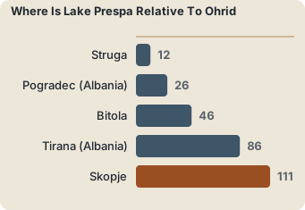
For orientation, the other day-trip destinations around Ohrid sit at these straight-line distances from the town:
| Destination from Ohrid | Straight-line distance |
|---|---|
| Struga | about 12 km |
| Pogradec (Albania) | about 26 km |
| Bitola | about 46 km |
| Tirana (Albania) | about 86 km |
| Skopje | about 111 km |
Prespa is not on that computed list, so this page prints no Prespa distance figure. What the sources do give is the elevation relationship, and that roughly 148 m difference between the two lake surfaces is the single most useful number for understanding the drive: everything between the Ohrid waterfront and the Prespa shore is climb, ridge, then descent.
How Do You Get From Ohrid To Lake Prespa?
The only practical route from Ohrid to the Macedonian shore of Lake Prespa is the road over Galicica National Park, the same ridge road that crosses between the two lakes. The park is open year-round, but heavy snow can close the main road, typically between January and March, and the sources do not license any entry fee, vehicle charge or road-opening date beyond that.
That last sentence deserves emphasis because a lot of second-hand guides print a park fee or a toll for the Galicica road. This page states none, because no figure for it can be confirmed. The same caution applies to journey times: none is available for Ohrid to Prespa. Plan the day around the road's character instead, a sustained climb from the Ohrid shore to the ridge, a stretch along the high ground, and a descent to the Prespa side, and check the Galicica live camera or the Ohrid weather page in winter months before committing.
The alternative to driving is a guided excursion. The Around The Lake Albania tour from Ohrid circles the Albanian side of the Lake Ohrid basin rather than crossing to Prespa, and it is the closest fit among the site's tour roster for travellers who want the border-lake region covered in a single booked day. It starts in Ohrid, which matters: several other products in the roster start in Tirana or Skopje and are not Ohrid departures.
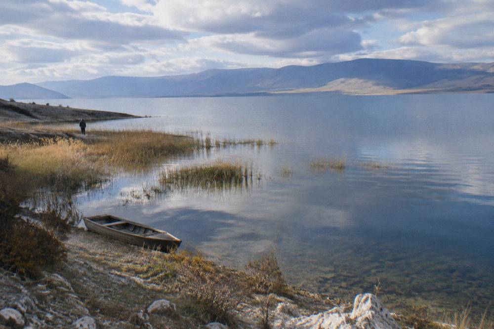
For independent travellers, the practical anchor points on the Ohrid side before the climb are the town's own sights, and the lanes of the old town sit at the base of the same slope the Prespa road ascends. If the day trip is part of a longer stay, the Ohrid in three days itinerary leaves room for exactly this kind of outing.
What To See On A Lake Prespa Day Trip From Ohrid?
A Prespa day trip from Ohrid is built around three things: the Galicica ridge road between the two lakes, the Prespa shoreline villages at the bottom of the descent, and the lake itself, which sits about 148 m above Lake Ohrid on the far side of the ridge. No entry fee, opening hour or attraction price on the Prespa side is verifiable from the sources, so the day is planned around landscape rather than ticketed sights.
That is not a limitation so much as the character of the trip. Unlike a day built around Ohrid's museum sites, where the museum institute's tickets are 120 den domestic and 150 den foreign at sites such as Robev Family House, the Prespa side of the ridge has no comparable ticketed circuit. The Galicica crossing is the attraction.
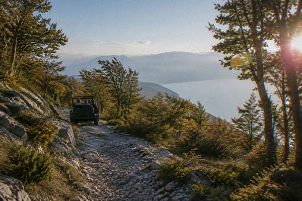
The ridge road is the centrepiece. Galicica National Park covers 22,750 ha between the two lakes, and the road over it gives views of both: Lake Ohrid behind, Lake Prespa ahead. For the park itself, the facts that hold are the 1958 proclamation, the 22,750 ha extent, the 2,254 m Magaro peak and the year-round opening with winter snow risk.
To take the ridge on foot instead of by road, book a Galicica hiking tour here.
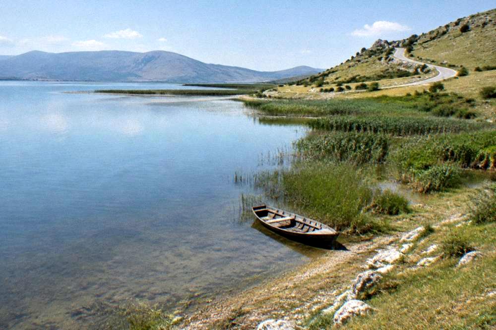
On the Prespa shore, the villages and beaches are small-scale and quiet, and the lake's long-term water decline means the shoreline itself changes over the years, a process the Lake Prespa shrinking answer documents. There is no reliable boat schedule, beach facility list or restaurant price for the Prespa side, so this page prints none.
Two booked products put the Galicica ridge at the centre of the day rather than the Prespa shore, and both are worth knowing about when shaping the trip:
| Product from the site's roster | What it covers | Where it starts |
|---|---|---|
| ATV Full Day Adventure through National Park Galicica Ohrid | The national park between the two lakes, by ATV | Ohrid |
| Jeep Safari National Park Galicica | The Galicica ridge and park tracks | Ohrid |
| Around the Lake Albania from Ohrid | The Albanian side of the Lake Ohrid basin | Ohrid |
| Ohrid Two Lakes Hiking Trail in Galicica | A hike between the two lake basins | Ohrid |
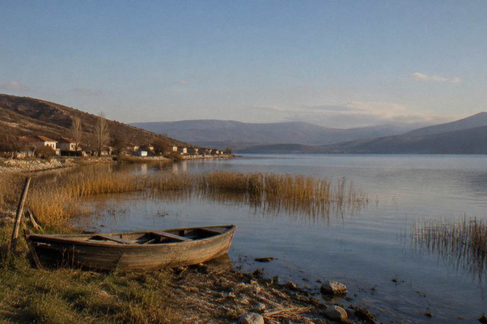
The Jeep Safari product also belongs on the shortlist for travellers who want the ridge without driving it themselves, and the site's Ohrid beaches guide collects the water-based counterparts for the Ohrid side of the day.
Prespa Or The Albanian Side Of Lake Ohrid: Which Day Trip From Ohrid?
For most of what a single booked day can deliver, the Albanian side of Lake Ohrid is the better-supported choice from Ohrid: it is covered by a guided excursion that starts in Ohrid, takes in the border town of Pogradec about 26 km away, and sits around the same lake as the town itself. Prespa rewards the traveller who specifically wants the high ridge crossing and a quieter, three-country lake, at the cost of fewer verifiable on-shore attractions.
The comparison is really between two different kinds of quiet. The Albanian-side trip, exemplified by the Around The Lake Albania excursion, keeps the day on the Lake Ohrid shoreline, crossing to Pogradec and the villages of the Albanian littoral. The Pogradec from Ohrid page covers the independent version of that route. Prespa, by contrast, is a mountain day with a lake at the end of it.
The St Naum monastery, about 4 km from the Tushemisht border crossing with Albania, often gets folded into the Albanian-side day, and the St Naum from Ohrid route by boat is the classic way to combine the two. None of that applies to Prespa: the Prespa trip goes the other way, up and over Galicica rather than around the Ohrid shoreline.
A simple way to separate the two days:
| Question | Prespa day | Albanian Lake Ohrid day |
|---|---|---|
| Main feature | The Galicica ridge crossing | The lakeshore and border region |
| Lake elevation | About 148 m above Lake Ohrid | Roughly 693 m above sea level |
| Guided product from Ohrid | ATV and jeep products cover the park | Around The Lake Albania excursion |
| Independent driving | Ridge road, snow risk January to March | Shore road via Struga toward the border |
When Is The Best Time Of Year For A Lake Prespa Day Trip From Ohrid?
The reliable window for a Prespa day trip is late spring through early autumn, roughly May to September, because the Galicica ridge road is open year-round but heavy snow can close it, typically between January and March. July and August bring the modelled ERA5 1991-2020 normals of 27.1 C and 27.6 C mean daily highs in Ohrid and only 34.7 mm and 32.9 mm of monthly rain, while May averages 19.5 C and 70.8 mm.
Those ERA5 figures are modelled reanalysis values for a grid cell over Ohrid, not a station record, and they describe the town at the base of the climb rather than the ridge itself, which sits far higher and runs cooler. What they establish is the seasonal pattern that matters for planning: the warm, dry middle of the year is when the ridge road is most dependably clear and the Prespa shore is most inviting.
| Month | Ohrid mean high (ERA5 1991-2020) | Ohrid mean low | Rain mm | Notes for the ridge crossing |
|---|---|---|---|---|
| April | 14.6 C | 6.3 C | 82.4 | Possible late snow on the ridge |
| May | 19.5 C | 10.8 C | 70.8 | Road typically clear |
| June | 24.2 C | 15.2 C | 43.1 | Long daylight, clear road |
| July | 27.1 C | 18.3 C | 34.7 | Peak season on Lake Ohrid |
| August | 27.6 C | 19.0 C | 32.9 | Peak season, busiest month |
| September | 22.4 C | 14.9 C | 62.4 | Quieter lake towns, road clear |
| October | 17.4 C | 10.3 C | 76.0 | Cooler, wetter, check conditions |
| January | 5.0 C | -0.8 C | 76.5 | Ridge road may close with snow |
August is the busiest month on the Ohrid side, a fact the is Ohrid crowded in August planning pages deal with at length, and Prespa's comparative quiet in the same weeks is part of its appeal for travellers who have already seen the Ohrid waterfront at full summer flow. The best time to visit Lake Ohrid answer applies the same seasonal logic to the water itself, and the swimming in Lake Ohrid guide carries the lake temperature context for anyone pairing a Prespa morning with an Ohrid swim in the afternoon.
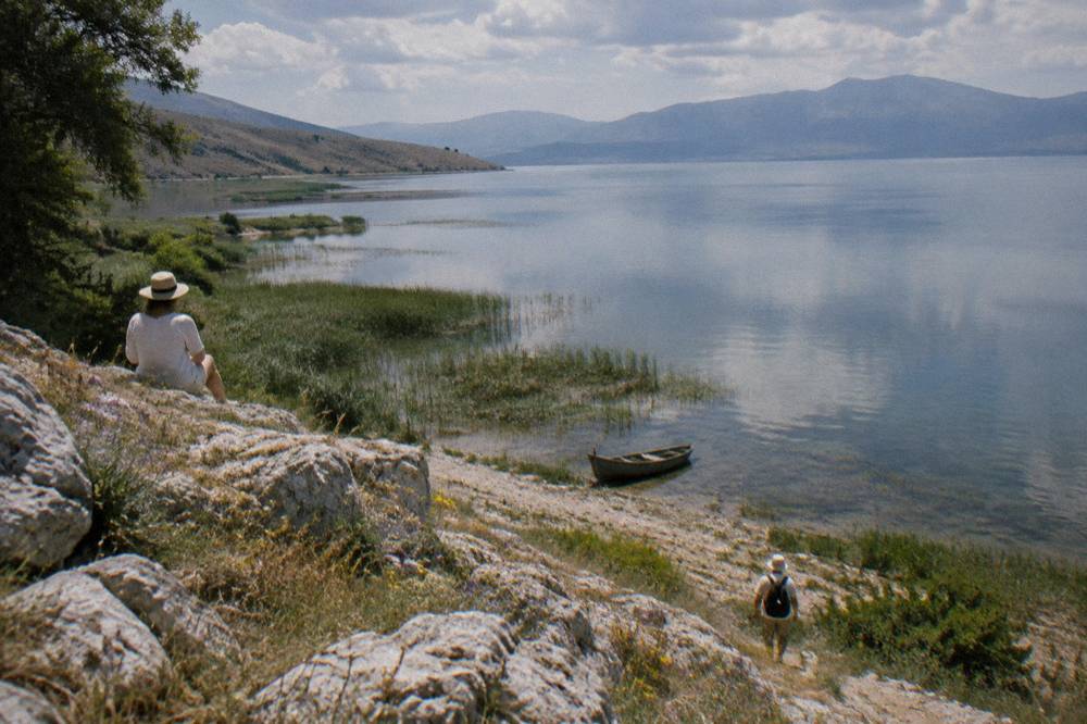
What Does A Lake Prespa Day Trip From Ohrid Cost?
A Lake Prespa day trip from Ohrid costs only what you cannot fix in advance: fuel and time for the ridge crossing, unverified food prices on the Prespa shore, and the operator's listing price if you book. Fixed comparison figures in the Ohrid day-trip orbit are 120 den domestic and 150 den foreign museum institute tickets, plus 150 MKD per person at St Naum monastery and Bay of Bones, all in MKD.
The honest cost picture is therefore a small one. Fuel and time for the ridge crossing, food on the Prespa shore at prices the sources do not verify, and, if the day is booked, the product price as shown on the tour page. The Ohrid cost and budget context pages handle the town's own costs, where the museum circuit is the main ticketed spend.
For comparison, the fixed figures that do exist in the Ohrid day-trip orbit:
| Item | Figure | Source basis |
|---|---|---|
| Museum institute tickets (Robev House, Bay of Bones, Icon Gallery) | 120 den domestic, 150 den foreign | muzejohrid.mk |
| St Naum monastery entry | 150 MKD per person | Cruise operator's listing |
| Bay of Bones entrance | 150 MKD per person | Cruise operator's listing |
The currency note that applies everywhere in North Macedonia applies here too: the denar is the local currency, euros are commonly quoted for tours but are not legal tender, and a local cost stays in MKD exactly as the source gives it. The denar and money guide is the site's fuller treatment.
What Else Pairs Well With A Prespa Day From Ohrid?
The natural pairings are the Ohrid-side sights at the base of the climb: St John at Kaneo on its promontory, the Bay of Bones museum on the water at Peshtani, and the boat routes along the shore, all of which sit within the same day-trip radius that the Prespa road shares. Prespa also combines with Struga, about 12 km straight-line from Ohrid, for a two-stop day in the opposite direction.
A common shape is a Prespa morning and an Ohrid afternoon: the ridge crossing early, the shoreline in the late day, when the town's churches and the Bay of Bones are still open under the museum institute's summer schedule, which runs 1 May to 30 September with two shifts at Robev Family House and 09:00 to 16:30 at the Museum on Water, both closed Monday. The winter schedule, 1 October to 30 April, shortens those hours, so an October Prespa day paired with museum visits needs the earlier start.
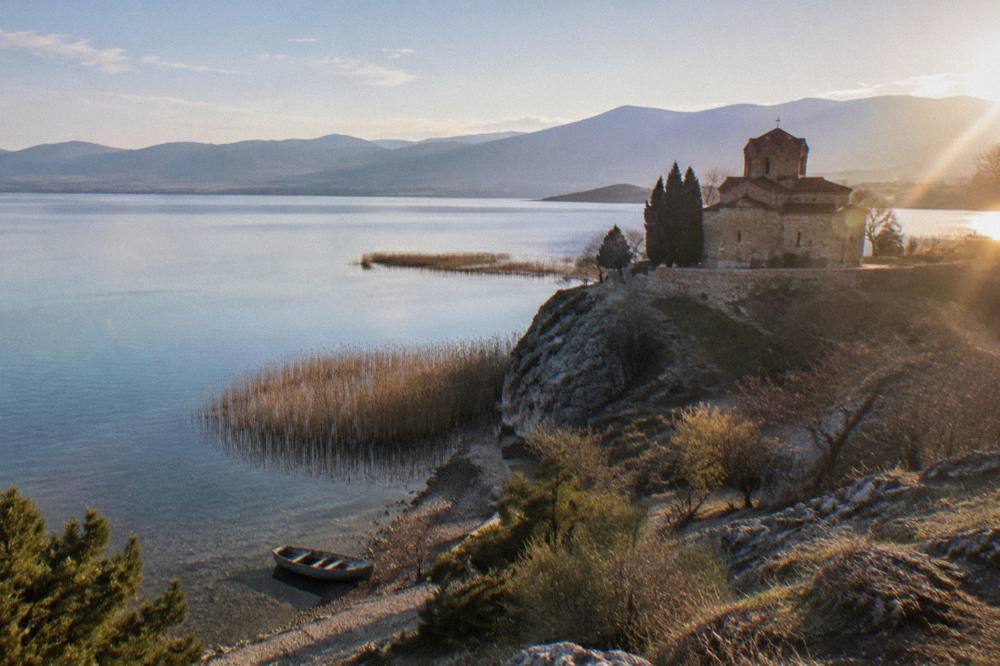
The water-side alternatives, if the ridge is closed or the day turns wet, are collected on the Lake Ohrid boats and ferries pages, and the Ohrid in the rain planning pages cover the indoor circuit. For a longer stay that gives Prespa its own full day, the five-day Ohrid itinerary is the natural frame.
Common Questions About A Lake Prespa Day Trip From Ohrid
How far is Lake Prespa from Ohrid?
No Ohrid-to-Prespa distance figure appears in the material. What it does give is the elevation relationship: the UHMR gauges on the two lakes put Prespa about 148 m above Lake Ohrid, which rests at roughly 693 m above sea level, with Galicica National Park occupying all the ground between them.
Do you need a ticket for Galicica National Park?
No entry fee, vehicle charge or per-person figure for Galicica appears in the sources this site uses, so none is printed. The park is open year-round, and heavy snow can close the main road, typically between January and March.
Can you see both lakes from the Galicica road?
Yes. The road over the ridge crosses Galicica National Park, which lies between Lake Ohrid and Lake Prespa, and it gives views of both lakes.
Is Lake Prespa worth visiting compared with Lake Ohrid?
Prespa is a quieter, higher lake shared by North Macedonia, Albania and Greece, reached by a mountain crossing, while Lake Ohrid carries the town, the churches and the boat routes. Travellers who want ticketed sights and boat schedules stay on the Ohrid side; travellers who want the ridge and the quiet shore go to Prespa.
When should you not attempt the Prespa crossing?
Between January and March, when heavy snow can close the main road over Galicica. The park is open year-round, but the road is the constraint, and the park's live camera page is the practical check before setting out.
Are there guided tours from Ohrid to Lake Prespa?
The site's roster carries ATV and jeep products that cross Galicica National Park between the two lakes, starting in Ohrid. A guided circle of the Albanian side of the Lake Ohrid basin is also available from Ohrid and can be checked via Check availability.
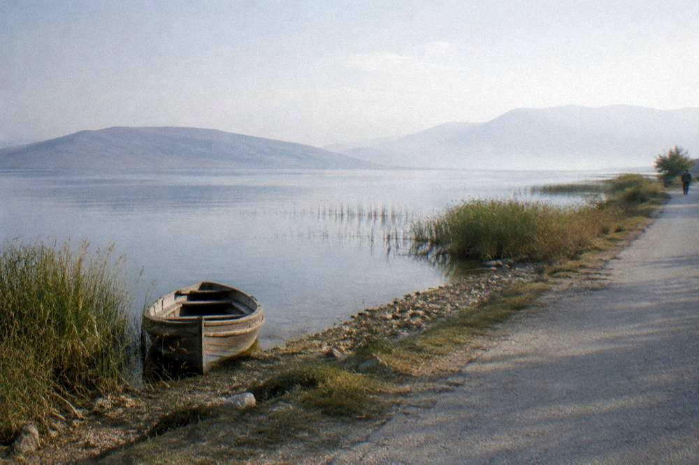
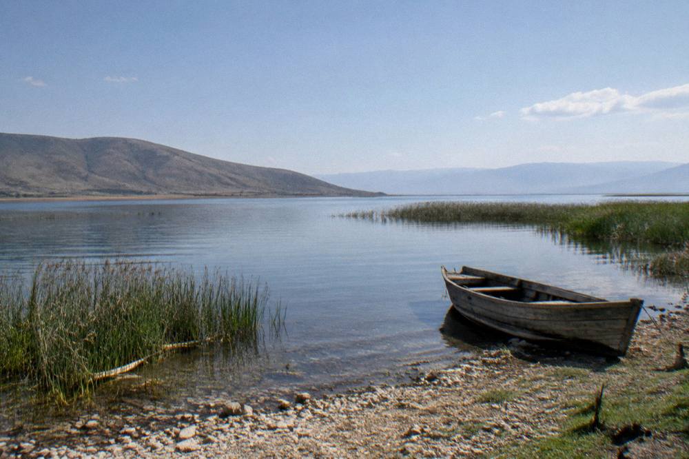
The short version: Prespa is Ohrid's quiet counterpart, one ridge away, about 148 m higher, shared by three countries, and at its dependable best from May to September when the Galicica road is clear and the lakes below are warm enough for a swim on the way home.