Sveti Stefan And The Eastern Shore: Hotels, Pebble Beaches And Nova Riviera
The eastern shore of Lake Ohrid, the stretch that runs from the bays below Ohrid's old town toward St Naum and the Albanian border, holds the town's swimming beaches, its hotel strip around Sveti Stefan and the Nova Riviera, and the quiet water that makes this side of the lake the swimming side.
Short answer
Sveti Stefan and the Nova Riviera sit on the eastern shore of Lake Ohrid in North Macedonia, where the pebble beaches of Gradiste, Lagadin, Potpesh, Labino and Ljubanista cluster along the water and Galicica National Park rises behind them. Boat cruises run about May to October, and swimming conditions hold from July into September.
Lake Ohrid sits at about 693 m above sea level, and on its eastern shore, below the ridge of Galicica National Park, runs the swimming coastline that serves Ohrid in North Macedonia. The Ohrid Travel Guide covers this shore as one area: the beaches of Gradiste, Lagadin, Potpesh, Labino and Ljubanista, the settlement at Sveti Stefan with its Nova Riviera beach-and-hotel stretch, and the shore road and boat routes that link them to Ohrid's old town and, at the far end, to St Naum and the Albanian border. It is a freshwater mountain lake, not a sea coast, and everything about the way this shore works follows from that.
Where Is Sveti Stefan On The Eastern Shore Of Ohrid?
Sveti Stefan sits on the eastern shore of Lake Ohrid in North Macedonia, the side of the lake below Galicica National Park, where the shore road and the boat routes link the old town of Ohrid to the beach bays of Gradiste, Lagadin, Potpesh, Labino and Ljubanista before the coast ends at St Naum, about 4 km from the Tushemisht border crossing with Albania.
That geography is the whole logic of the area. Ohrid's old town, its churches and its Old Bazaar sit on the north corner of the lake; the eastern shore is where the town goes to swim. The shore is a string of bays rather than one continuous promenade, each with its own name and its own mix of pebble and stone. Behind all of it, the ridge of Galicica National Park separates Lake Ohrid from Lake Prespa, and the park's recorded height at Magaro peak is 2,254 m, with the park covering 22,750 ha between the two lakes.
The lake level itself matters to anyone reading about this coast. The hydrological service gauge reads about 693 m above sea level, within a band the authorities keep between agreed minimum and average marks. In practice the water line on the pebble beaches shifts a little through the season, and the swimming shelf stays long and shallow, which is one reason families base themselves on this side of the lake.
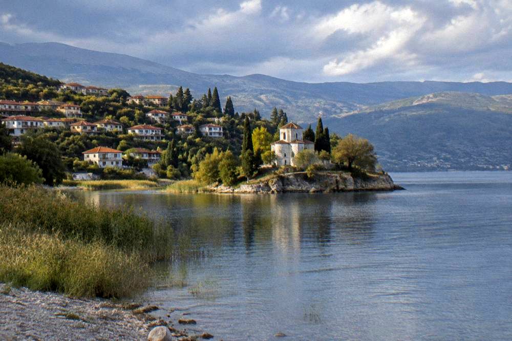
The area is best understood as three loose zones. Closest to town sit the bays of Potpesh and Labino, reachable on foot or by short taxi hops from the centre. Further along, Gradiste and Lagadin form the busy middle, the stretch where the biggest concentration of beach facilities sits and where the shore road runs almost level with the water. Beyond them, Trpejca and Ljubanista and finally St Naum make up the far end, quieter, greener, and tied to the monastery and the border. The Trpejca and Ljubanista guide covers that far end in detail.
Which Pebble Beaches Line The Eastern Shore Of Ohrid?
The named swimming beaches on Ohrid's eastern shore are Gradiste, Lagadin, Ljubanista, Potpesh and Labino, all described in guides to the lake as pebble or mixed pebble-and-stone shores with clear water, with Gradiste and Lagadin on the busy middle stretch, Potpesh and Labino nearest the town, and Ljubanista at the far end below the road to St Naum.
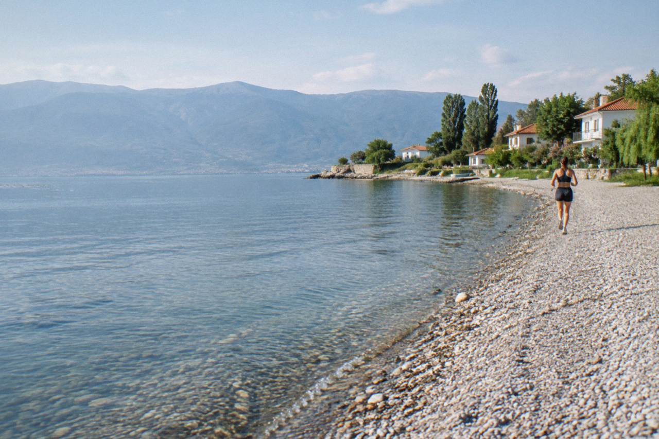
Pebble, not sand, is the honest word for this coast. Guides to the lake's beaches list pebble and mixed shores throughout, which means water shoes earn their place in the bag and the water itself stays strikingly clear, since fine sand is what clouds a swimming lake. The clear water is not a slogan: it is a direct consequence of the geology, and it is why snorkelling, diving and paddleboarding all work so well off these same beaches.
| Beach | Position on the eastern shore | Shore type |
|---|---|---|
| Potpesh | Nearest Ohrid town centre | Pebble and mixed |
| Labino | Close to town, small bay | Pebble and mixed |
| Gradiste | Middle stretch, main beach facilities | Pebble and mixed |
| Lagadin | Middle stretch | Pebble and mixed |
| Ljubanista | Far end toward St Naum | Pebble and mixed |
Two cautions keep this table honest. Second, the water testing is genuinely worth reading: the Institute of Public Health's 2026 bathing results, reported in June, rated the lake's bathing waters Class I physico-chemically at every measured point except Grashnica beach, which came back Class III, with most microbiological samples rated Excellent. Grashnica sits on the northern edge of the town end of the shore, and the same reporting noted wastewater pressure from properties not yet connected to the sewer collector between St Naum and Radozda. The cleanest swimming on this coast is the open middle and far shore, away from the town-end problem points.
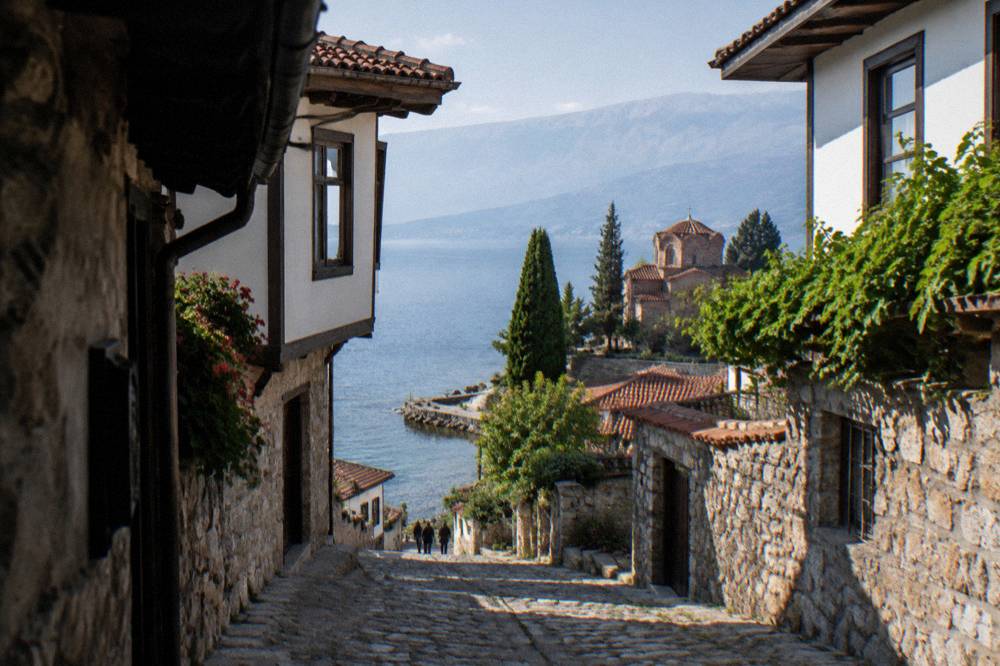
For planning a beach day, the practical split is simple. The middle bays carry the seasonal beach facilities, sun beds and food, and they fill through July and August, the months the guides name as peak season with August the busiest. The town-end bays work best as short swims bolted onto a day in the old town, and the far-end beaches pair naturally with a boat trip or a drive to St Naum. The beaches of Ohrid guide goes beach by beach in more depth.
When Can You Swim In Lake Ohrid From The Eastern Shore Beaches?
The swimming season on Lake Ohrid runs about July to September, the months when modelled surface temperatures sit at or above roughly 20 C: July averages about 22.9 C, August about 23.5 C, and September still about 19.7 to 25 C depending on the dataset, while the official October multi-year mean from the hydrological service is 14.3 C, which puts a hard edge on the season.
Those monthly figures are modelled aggregator values, not gauge readings, so read them as bands rather than promises. May and June warm fast, from about 14.9 to 18.7 C in May with further warming by late June, and the water cools just as fast after September. Anyone hoping to swim in spring should look at late June rather than May.
| Month | Modelled surface temperature | Realistic for swimming? |
|---|---|---|
| April | about 10.5 C | No |
| May | about 14.9 to 18.7 C | Brief dips |
| June | about 19.4 to 22.5 C | From late June |
| July | about 22.9 to 24.4 C | Yes |
| August | about 23.5 to 25.8 C | Yes, peak |
| September | about 19.7 to 25 C | Early September yes |
| October | about 14.3 C (multi-year mean) | No |
One 2026 rule matters to swimmers and boaters alike. A government decision of 2 June 2026 introduced lake navigation limits for the season: jet skis are banned between 1 July and 31 August from 11:00 to 19:00, and boats are banned at night between 3 June and 31 August from 21:00 to 05:00, with a further October limit. For swimmers on the eastern shore beaches this means the peak-afternoon water is reserved for people and paddle craft, and for anyone booking an evening boat experience it means the schedule follows these windows rather than open water.
Families planning around this should also read the lake's rhythm alongside the air temperatures. August's modelled daily high averages 27.6 C and July's 27.1 C, with nights around 18 to 19 C, so a full beach day is comfortable at the height of summer. The Ohrid with kids itinerary builds a whole trip around exactly this combination of shallow pebble bays and short boat hops.
What Kinds Of Hotels And Stays Sit Around Sveti Stefan And The Nova Riviera?
Stays around Sveti Stefan and the Nova Riviera stretch cluster along the eastern shore's middle and far sections, from hotel complexes beside the Gradiste and Lagadin bays to smaller guesthouses in the shore villages, and the season shapes everything: many lake hotels reduce operations or close parts of their facilities in winter, while year-round options exist at lower occupancy, and August, the busiest month, fills the strip first.
No nightly rate belongs on this page, because hotel pricing on this coast moves with the season and the booking channel, and quoting one here would mislead. What is stable and worth planning around is the seasonal pattern. The tourist season on the lake runs roughly May and June through September and October. Beach bars and beach facilities on the eastern shore reduce service or close outside that window, and boats to St Naum run about May to October with a reduced winter schedule.
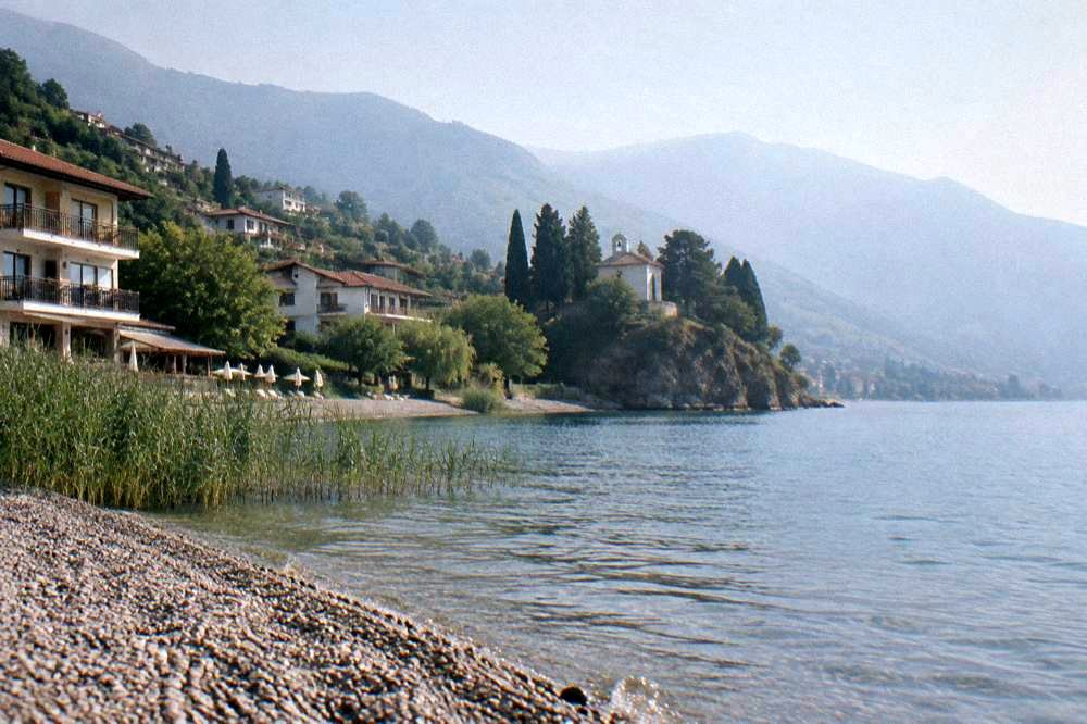
Choosing where on the shore to sleep is mostly a choice between three positions. The middle bays put the beach facilities and the boat departure points at the door, at the cost of sharing August with everyone else. The town end puts the old town's churches and restaurants in walking reach, with the beaches a short hop away. The far end, around Trpejca and Ljubanista, trades convenience for quiet water and green shoreline. Each position is covered in its own area guide, and the Lagadin and Peshtani page handles the middle bays specifically.
Deciding which bay suits your stay. Book a hotel in Ohrid here.
A practical booking note that comes from the shore itself rather than from any hotel: since August is the busiest month of the June-to-September peak, travellers set on an August stay on the eastern shore book earlier than they would for June or September, and shoulder-month visitors get the same beaches with the season's edges still open.
How Do You Travel The Eastern Shore Of Ohrid: Boat, Road Or Paddleboard?
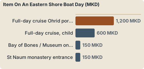
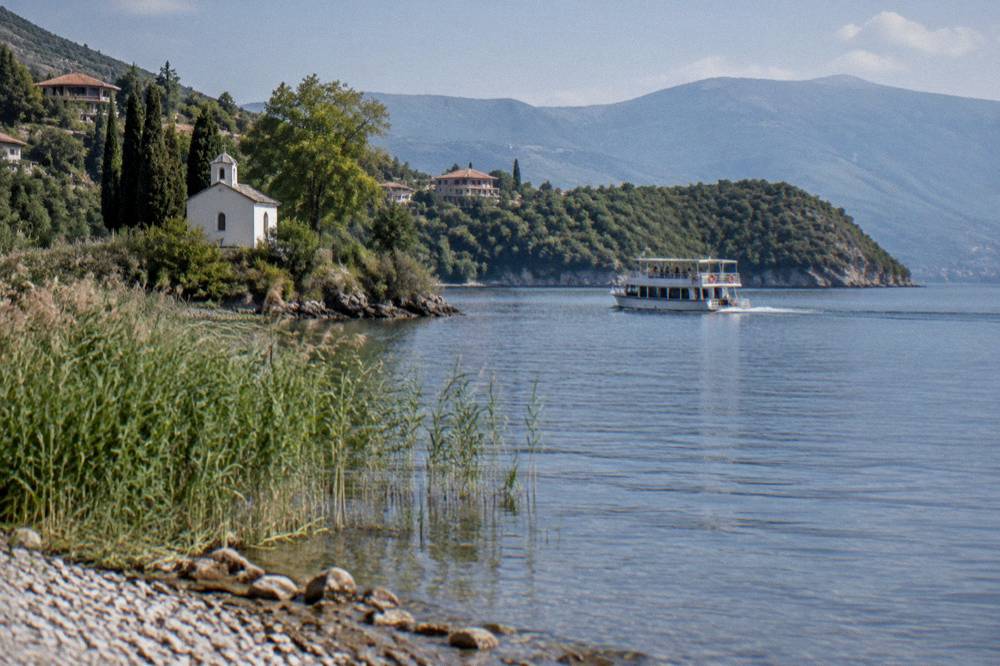
The eastern shore is served three ways: seasonal boat cruises from Ohrid's port along the coast toward St Naum, one operator's full-day cruise listing 7 hours from 1,200 den for an adult and 600 den for a child; the shore road, which carries local buses and taxis between Ohrid, Struga and the shore villages; and paddle craft, which launch from the beaches and tour the bays close to the waterline.
The boat option doubles as sightseeing. The full-day cruise run by Boat Armada lists a route from Ohrid port toward St Naum with stops on the way, and its ticket terms state that entrance to the Bay of Bones museum site, 150 MKD, and St Naum monastery, also 150 MKD, are not included in the cruise fare. The rowboat ride through the Crn Drim springs at St Naum is quoted by the same operator at about 5 EUR. That makes a full boat day easy to budget: cruise fare in denars plus two entrances plus an optional springs ride.
| Item on an eastern shore boat day | Cost as listed |
|---|---|
| Full-day cruise Ohrid port to St Naum, adult | from 1,200 MKD |
| Full-day cruise, child | from 600 MKD |
| Bay of Bones / Museum on Water entrance | 150 MKD per person |
| St Naum monastery entrance | 150 MKD per person |
| Rowboat at the Crn Drim springs | about 5 EUR |
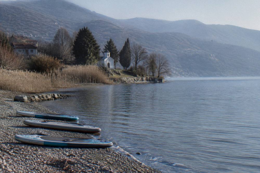
On the water under your own arm, a guided stand up paddleboard tour covers this coastline the way no road or boat does, drifting past the pebble bays of the eastern shore at water level, a slower and quieter counterpart to the motorised cruise described above. The paddleboard option runs as a small-group session with the beaches and headlands of this coast as the route, and Check availability if the water-temperature table above has picked your week.
By road, the shore road is the spine of the area, and local buses run it between Ohrid and Struga and the shore villages at low fares, with taxis covering the gaps; the drive to the far end reaches St Naum, and the monastery area sits about 4 km from the Tushemisht border crossing. The 2026 navigation limits above apply to the water, not the road, and the resident-only parking regime introduced on some old-town streets in summer 2026 does not reach the eastern shore beaches, though it does affect where a car can be left in the town itself before you set out. A one day in Ohrid plan sequences the town, a cruise and a beach stop in a workable order.
What Activities Work From The Eastern Shore Of Ohrid?
The eastern shore is Ohrid's activity base: stand up paddleboarding and kayaking off the pebble beaches, scuba diving in the lake with try-dive sessions listed at the Bay of Bones, boat cruises from the port along the whole coast, and hiking trails into Galicica National Park above the shore, including a two-lakes trail that climbs between Lake Ohrid and Lake Prespa.
The water activities concentrate here for the reasons the beaches section explains: clear water, a long shallow shelf and sheltered bays. Diving in a freshwater mountain lake is a different sport from sea diving, quieter, colder at depth and dependent on visibility, and the lake's try-dive products are built around first-timers rather than certified depth. Paddleboarding needs no certification at all, and the guided tours that run along this coast keep to water that beginners can handle.
Above the shoreline, the park changes the menu. Galicica, North Macedonia's second national park, dates from 1958 and spans 22,750 ha between the two lakes, with Magaro peak at 2,254 m. It is open year-round, though heavy snow can close the main park road, typically between January and March, and the park charges 250 MKD per vehicle with no per-passenger fee, or 100 MKD for someone entering on foot from the Ohrid-side gate. The park's own website runs a live camera page, useful for checking the ridge conditions before committing to a trail day.
For a trip that mixes these options, the two days in Ohrid itinerary sequences the shore, a boat day and a town day in a workable order, and the swimming and activity pages of this guide carry the seasonal detail for each.
What Is The Weather Like On Ohrid's Eastern Shore Through The Year?
Ohrid's climate normals, modelled from the ERA5 reanalysis for 1991 to 2020, show July and August averaging daily highs of 27.1 C and 27.6 C with lows near 18 to 19 C, and winter months from November through March with highs between 5 and 11.5 C and lows around or below freezing, with annual precipitation totalling 816.6 mm.
The numbers matter to this shore more than to the town, because the beach season and the water season run on slightly different clocks. The air is beach-ready from June, but the modelled lake surface temperature only reaches that mark in July, and the September air high of 22.4 C still pairs with swimmable early-autumn water. Snow falls in Ohrid in winter, and Galicica above the shore holds more of it, which is what closes the park road in the deep winter months.
| Month | Mean daily high | Mean daily low | Precipitation |
|---|---|---|---|
| Jan | 5.0 C | -0.8 C | 76.5 mm |
| Feb | 6.3 C | 0.0 C | 74.3 mm |
| Mar | 10.0 C | 2.5 C | 80.5 mm |
| Apr | 14.6 C | 6.3 C | 82.4 mm |
| May | 19.5 C | 10.8 C | 70.8 mm |
| Jun | 24.2 C | 15.2 C | 43.1 mm |
| Jul | 27.1 C | 18.3 C | 34.7 mm |
| Aug | 27.6 C | 19.0 C | 32.9 mm |
| Sep | 22.4 C | 14.9 C | 62.4 mm |
| Oct | 17.4 C | 10.3 C | 76.0 mm |
| Nov | 11.5 C | 5.3 C | 90.4 mm |
| Dec | 6.2 C | 0.9 C | 92.6 mm |
These are modelled reanalysis values for a grid cell over Ohrid at about 701 m, not readings from a weather station, and they carry no ranking: December totals 92.6 mm of rain and August 32.9 mm, stated as figures rather than labels. November and December are the months with the highest rain totals, 90.4 mm and 92.6 mm, while June through August bring the least rain, which is the weather pattern behind the July-to-September swimming season. The full monthly breakdown lives on the beaches of Ohrid page, and the swimming detail pairs with the water-temperature table earlier on this page.
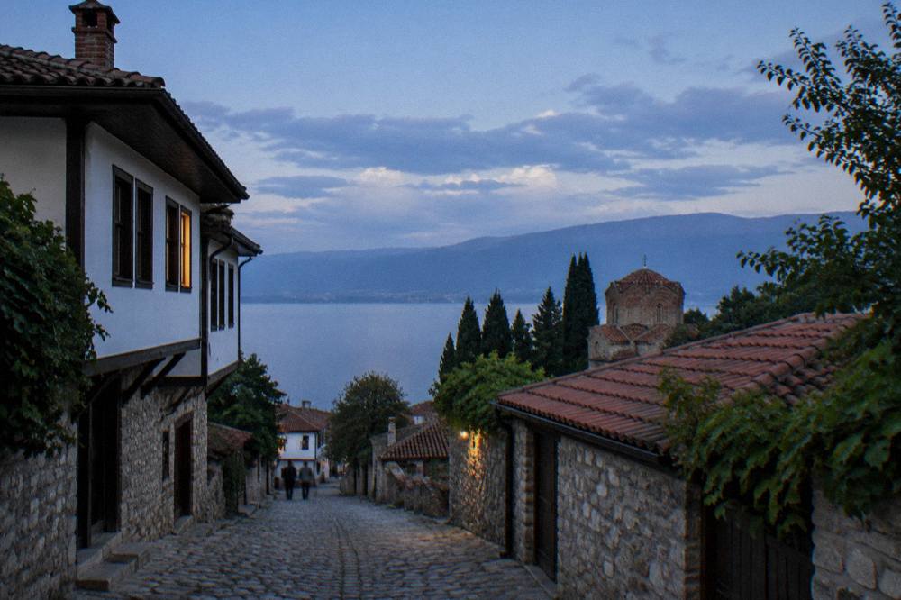
Where Does The Eastern Shore Of Ohrid End: St Naum And The Border?
The eastern shore ends at St Naum, the monastery complex at the Crn Drim springs on the border end of the lake, about 4 km from the Tushemisht border crossing into Albania, a crossing reported open around the clock for passengers and pedestrians, which makes Pogradec and the Albanian side of the lake a realistic extension of a shore day rather than a separate expedition.
St Naum rewards the drive or the cruise. The monastery entrance is listed at 150 MKD, the rowboats at the springs cost about 5 EUR, and the springs themselves, where the Crn Drim water rises before flowing north toward Ohrid and Struga, are the natural end point of any eastern shore itinerary. The St Naum monastery page covers the site itself, and the walking route down from the monastery plateau to the springs is short.
Crossing at Tushemisht works on foot as well as by car, and Pogradec on the Albanian side is close enough that this guide treats it as a day trip; the Pogradec from Ohrid page handles the border practicalities, including the point that North Macedonia is not in the EU or Schengen, so passport checks apply and UK visitors may stay up to three months. Allow border time rather than planning the crossing to the minute.
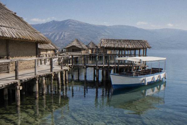
On the way back along the shore, the Bay of Bones museum site at Gradiste, the reconstructed pile-dwelling settlement on the water that gives the middle shore its name and its best rainy-day stop, charges 150 MKD foreign and 120 MKD domestic entry under the museum institute's ticket system, closed Mondays, on a winter schedule from 1 October to 30 April. It anchors the far half of the shore route as firmly as the beaches anchor the near half.
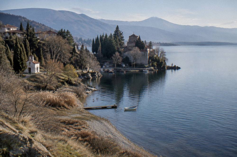
Common Questions About Sveti Stefan And The Eastern Shore Of Ohrid
Is Sveti Stefan on Lake Ohrid the same place as Sveti Stefan in Montenegro?
No. Sveti Stefan on the eastern shore of Lake Ohrid is a small lakeside settlement in North Macedonia, part of the beach and hotel stretch sometimes called the Nova Riviera. The better-known Sveti Stefan is a fortified islet resort on the Adriatic coast of Montenegro, several hours away by road and unconnected to this lake.
Are the eastern shore beaches sandy or pebble?
Pebble and mixed pebble-and-stone, at all the named beaches: Gradiste, Lagadin, Ljubanista, Potpesh and Labino. There is no sand beach on this shore, so water shoes are the standard advice, and the payoff is very clear water over the pale stones.
When is the water warm enough to swim at the eastern shore beaches?
About July to September. Modelled surface temperatures average about 22.9 C in July, 23.5 C in August and 19.7 to 25 C in September, against the official October multi-year mean of 14.3 C. Late June usually works; May is for braver swimmers.
Can you get to the eastern shore beaches from Ohrid town without a car?
Yes. Local buses run between Ohrid, Struga and the shore villages at low fares, taxis cover the same road, and seasonal boat cruises run from Ohrid port along the coast, with one operator's full-day cruise listed from 1,200 den for an adult. Boat service runs about May to October with a reduced winter schedule.
Is the water clean for swimming on the eastern shore?
The 2026 bathing results from the Institute of Public Health rated the lake's waters Class I physico-chemically at every measured point except Grashnica beach, which rated Class III, and most microbiological samples came back Excellent. The open middle and far shore beaches came through the testing well; the town-end problem points are the ones the reporting flagged.
Can you combine the eastern shore with a visit to Albania?
Yes. The shore ends at St Naum, about 4 km from the Tushemisht border crossing, which is reported open around the clock for passengers and pedestrians. North Macedonia is not in the EU or Schengen, so carry a passport, and Pogradec on the Albanian side works as a day trip from the lake.