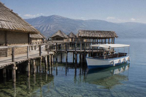
Lagadin And Peshtani: The Quieter Southern Shore
Lagadin and Peshtani sit on the southern shore of Lake Ohrid, a short drive east of Ohrid's old town, and they trade the old town's crowds for beaches, the Bay of Bones museum and a slower lake rhythm.
Short answer
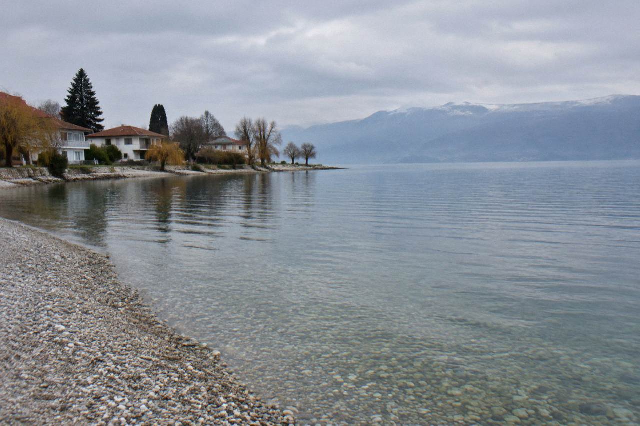
Lagadin and Peshtani are two lakeside villages on the southern shore of Lake Ohrid, downstream of Ohrid's old town towards St Naum. Peshtani is the larger of the two and sits beside the Bay of Bones (Museum on Water); Lagadin is a smaller beach settlement closer to town. Both are summer swimming bases with boat access along the shore.
Lake Ohrid sits at about 693 m above sea level in North Macedonia, and its southern shore, running east from Ohrid towards St Naum, holds two villages that many day-trippers pass without stopping: Lagadin and Peshtani. The Ohrid Travel Guide covers the whole lake region, and this page is about that southern stretch: what the two places are, what sits on and beside the water there, how to reach them, and how they fit alongside the better-known stops covered in things to do in Ohrid.
The distinction between the two matters for planning. Peshtani is the larger village and gives its name to the municipality area around Gradiste, where the Bay of Bones, the museum institute's Museum on Water, stands on piles over the lake. Lagadin is smaller, closer to Ohrid, and appears in guides mainly as one of the lake's named swimming beaches. Neither is a sight-dense town in the way Ohrid's old town is; both are bases and stop-offs on the lake road and the boat routes that link Ohrid with the southern shore and, at the far end, St Naum.
Where Are Lagadin And Peshtani On Lake Ohrid?
Lagadin and Peshtani are villages on the southern, Macedonian shore of Lake Ohrid, east of Ohrid's old town on the road and boat route that continues towards Trpejca, Ljubaništa and St Naum at the lake's southern end. The lake itself sits at about 693 m above sea level, and Galicica National Park, 22,750 hectares between Lake Ohrid and Lake Prespa, rises on the landward side of the whole shore.
The geography frames everything about the two places. Galicica was declared North Macedonia's second national park in 1958, and its ridge, with Magaro peak at 2,254 m, separates the Ohrid basin from the Prespa basin. Lake Prespa's gauge at Nakolec read 841.36 m in October 2026, about 148 m above Lake Ohrid, so the villages on the southern shore literally sit at the foot of a mountain wall with another lake behind it. That setting is why the shore here is a chain of bays and beach pockets rather than a long promenade.
Where the two villages sit relative to each other is simple: Lagadin is the nearer to Ohrid, Peshtani farther along, with Gradiste and the Bay of Bones at Peshtani's edge. Beyond Peshtani the shore continues to Trpejca and Ljubaništa, then to the far southern tip and the villages and beaches covered on the eastern shore page. Everything on this page is a day trip or half-day hop from Ohrid, never a separate destination requiring an overnight move, unless you specifically want a beach-base holiday away from the old town.
The southern shore also has a cross-border dimension. The St Naum end of the lake lies about 4 km from the Tushemisht border crossing into Albania, and Pogradec, on the Albanian side, is a common extension, covered on the Pogradec day-trip page. Lagadin and Peshtani are the first links in that chain east of town.
What To Do In Lagdin And Peshtani Beyond The Beach?
The two draws that carry a named price on this shore are swimming, which is free at the beaches listed in lake guides, and the Bay of Bones (Museum on Water) at Gradiste near Peshtani, one of the museum institute's sites; everything else is lake time, boat time and food, and the full-day boat cruise from Ohrid port to St Naum calls at stops along this shore, from 1,200 den for an adult and 600 den for a child per the operator's listing.
Start with the water. Lake guides list Gradiste, Lagadin, Ljubaništa, Potpeši and Labino as the lake's popular swimming spots, all pebble or mixed shores with clear water. The 2026 bathing tests reported by the Institute of Public Health rated the lake's water Class I physico-chemically at most sampled points, with Grashnica beach the exception at Class III, and most microbiological samples came back "Excellent". Grashnica sits near Ohrid itself, not on this southern stretch, but the report is the reason to check the current results rather than assume every bay is identical.
Swimming here is a seasonal activity, and the season is defined by water temperature. Modelled aggregator values put the lake surface at about 4.6 C in January, rising through about 10.5 C in April to about 22.9 C in July and 23.5 C in August, then falling back to about 14.7 C in October. The October mean from the hydrological service's own multi-year record is 14.3 C. In practice the comfortable swimming months are July to September.
The Bay of Bones is the shore's one indoor-grade sight, and it is covered in depth on the Bay of Bones page. The museum institute runs it as the Museum on Water, a reconstruction on piles at Gradiste. Its opening days, hours and ticket figures change by season and belong to the museum's own channels; the section below covers how it fits into a Peshtani day rather than what it charges.
Between the beaches and the museum, the remaining activities on this shore are water-borne: boat cruises, the subject of the Ohrid boat tour guide, and the paddling options covered among the lake's activity tours. One dated rule shapes summer boating: under a government decision of 2 June 2026, jet skis are banned on the lake from 1 July to 31 August between 11:00 and 19:00, and boats are restricted at night from 3 June through the summer, part of a swimmer-safety regime running into October 2026. It is a 2026 measure, not a permanent law.
For a paddle along this shore, book a stand-up paddleboarding tour here.
A different way to spend a shore afternoon is at the stove. Ohrid cooking classes run from the town and take Macedonian home cooking as their subject, and the roster's own cooking class is one of the site's featured picks for travellers who want the lake's food culture rather than only its water.
The wine angle deserves a sentence of its own. The lake has a small but real wine scene, and one of the more social products on the roster combines both: a boat cruise on Lake Ohrid with unlimited wine during the sail. It runs from the town side, so it works as an evening complement to a daytime southern-shore trip rather than something based in Lagadin or Peshtani themselves.
How Do You Get To Lagadin And Peshtani From Ohrid?
The southern-shore villages are reached from Ohrid by road along the lake's eastern shore or by boat. The drive from Skopje is about 170 km taking roughly 2.5 hours by car with about 140 MKD in motorway tolls, while the bus takes about 3 hours and costs 850 to 950 MKD one way, and no passenger train serves Ohrid at all.
That table of trunk facts sets the frame, because everything on the southern shore is a local hop from Ohrid town:
| Journey | Figure the sources give | Notes |
|---|---|---|
| Ohrid airport to centre | about 10 km | airport on the E65, access by car or taxi |
| Skopje to Ohrid by car | about 172 km, about 2.5 h | about 140 MKD in tolls at the plazas |
| Skopje to Ohrid by bus | about 3 h | 850 to 950 MKD one way |
| Tirana to Ohrid by minibus | 3 to 3.5 h including the border | about EUR 15 to 20, roughly 5 to 7 departures a day |
| Ohrid to Struga local bus | 100 to 150 MKD one way | older guide figures; confirm the current fare |
| Passenger train to Ohrid | none | no rail service reaches the town |
Within the lake, the southern shore is also a boat corridor. The full-day cruise from Ohrid port to St Naum run by the Boat Armada operator takes 7 hours, from 1,200 den per adult and 600 den per child, and its route along this shore is the reason many travellers see Peshtani and Gradiste from the water first. Boat services to St Naum generally run about May to October and thin out in winter, while the road to St Naum stays open, so an off-season visit to the shore villages is a road trip, not a boat trip.
Driving has two local wrinkles worth knowing. Headlights must be on day and night in North Macedonia, tolls are paid per section at plazas (there is no vignette), and a green card should be carried for insurance. The bigger road story is the Kicevo to Ohrid motorway: the Izvor to Vrbjani section, about 10 km including the Preseka tunnel, was reported as due to open in the coming months, with full opening of the A2 expected in the first half of 2027. That affects arrivals from the north and west, not the short lakeside hop to Peshtani.
In Ohrid town itself, parking tightened in summer 2026: streets in the old part including Ilindenska, Kosta Abrash and Car Samoil became resident-only, with clamping reported for non-residents. Anyone basing themselves in the old town and driving out to the southern shore beaches should plan around that regime, which dates from 2026 and may be adjusted.
One more way to see the shore needs no vehicle at all once you are out here: the self-guided audio tour in the picks above covers Ohrid's antiquity and can be walked at whatever pace a shore day allows. Check availability if a day split between Peshtani's beaches and the town's ancient sites appeals.
Where Does The Bay Of Bones Fit Into A Peshtani Day?
The Bay of Bones (Museum on Water) stands at Gradiste on the water's edge at Peshtani, and the museum institute lists it among its sites alongside Robev Family House and the Icon Gallery; the practical shape of a visit is simple: it closes on Mondays, runs a winter schedule from 1 October to 30 April and a summer schedule from 1 May to 30 September, and this page leaves its ticket figures to the museum's own channels because they change and belong to the institute.
The site is the southern shore's anchor sight, and pairing it with a swim is the natural day shape. Gradiste is itself one of the named swimming beaches, so the same stop can carry both the museum and a swim in the middle of the day. Peshtani village sits at the stop before it on the shore road.
A second pairing works by boat: the full-day Ohrid to St Naum cruise calls along this shore, and the Bay of Bones is a regular stop on such routes. Travellers who prefer to keep the day water-based can ride out from Ohrid port and let the boat do the shore-hopping, then return by boat or road. The rowboats at St Naum's springs, about 5 EUR per boat per one operator's listing, are at the far end of the same corridor rather than at Peshtani, so budget them for the St Naum leg, covered on the St Naum day-trip page.
What the museum actually shows is prehistory on the lake: the Museum on Water is a reconstruction of a pile-dwelling settlement, part of the museum institute's roster. The depth of its story sits on its own attraction page; from a planning angle, the point is that it is the one sight on this shore that belongs on every first-visit list, and the Monday closure is the single scheduling fact most likely to sink a plan.
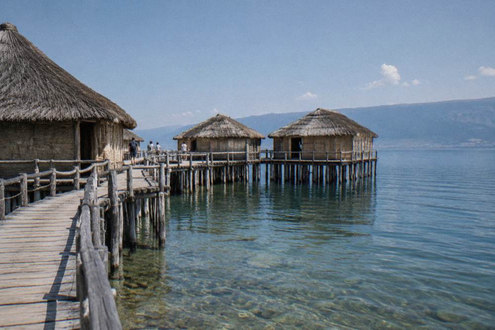
For anyone building the day around it, the shape that works is: Peshtani and the Bay of Bones in the morning, Gradiste beach for the middle of the day, then either back towards Ohrid with a stop in the old town, or onwards east to Trpejca and Ljubaništa if the day is long. In high summer, remember the 2026 daytime jet-ski ban and the night boat limits; they exist precisely because this shore's water is full of swimmers in July and August.
When Is The Best Time To Swim On The Southern Shore Of Lake Ohrid?
July to September is the swimming season, and the numbers behind it are modelled lake-surface values: about 22.9 C in July, 23.5 C in August and a September range reported between about 19.7 and 25 C depending on the dataset, against 4.6 C in January and about 14.7 C in October.
Those figures come with labels. The air numbers are ERA5 reanalysis climate normals for a grid cell over Ohrid, 1991-2020, not a weather-station record: 27.1 C average daily highs in July and 27.6 C in August, falling to 5.0 C in January. The water numbers are modelled aggregator values except the October mean of 14.3 C, which comes from the hydrological service's multi-year record. The full monthly picture:
| Month | Mean daily high C (ERA5 1991-2020) | Mean daily low C | Rain mm | Modelled lake surface C |
|---|---|---|---|---|
| Jan | 5.0 | -0.8 | 76.5 | about 4.6 |
| Feb | 6.3 | 0.0 | 74.3 | about 5.4 |
| Mar | 10.0 | 2.5 | 80.5 | about 7.2 |
| Apr | 14.6 | 6.3 | 82.4 | about 10.5 |
| May | 19.5 | 10.8 | 70.8 | about 15 to 19 |
| Jun | 24.2 | 15.2 | 43.1 | about 19 to 23 |
| Jul | 27.1 | 18.3 | 34.7 | about 23 |
| Aug | 27.6 | 19.0 | 32.9 | about 24 |
| Sep | 22.4 | 14.9 | 62.4 | about 20 to 25 |
| Oct | 17.4 | 10.3 | 76.0 | about 14.7 |
| Nov | 11.5 | 5.3 | 90.4 | about 10.3 |
| Dec | 6.2 | 0.9 | 92.6 | about 6.0 |
The rain column tells its own story: December carries 92.6 mm in the modelled normals and November 90.4 mm, while July and August sit at 34.7 mm and 32.9 mm. November's 90.4 mm and December's 92.6 mm are the two highest monthly totals in the table. For a beach-base trip to Lagadin or Peshtani, that curve plus the water temperature curve points at July and August for swimming and May, June and September for everything else on the shore with cooler water.
Peak season on the lake runs June to September, with August the high point for busy beaches and full accommodation, per the guides that cover the lake's seasonality. Off-season, the same villages are quiet road-trip stops: the museum schedule shortens from October, boats to St Naum reduce, and the shore's beach facilities wind down, while the road and the villages stay open year-round.
Where Should Lagadin And Peshtani Sit In An Ohrid Itinerary?
As a half-day or full-day loop from Ohrid, not as a replacement base for a first visit: the one-day and two-day itineraries keep the old town's churches, Samuel's Fortress, the Ancient Theatre and the Old Bazaar at the centre, and slot the southern shore in as the water-and-beach counterweight, usually as a boat day to St Naum with a Bay of Bones stop, or as a road afternoon to Peshtani and Gradiste with a swim.
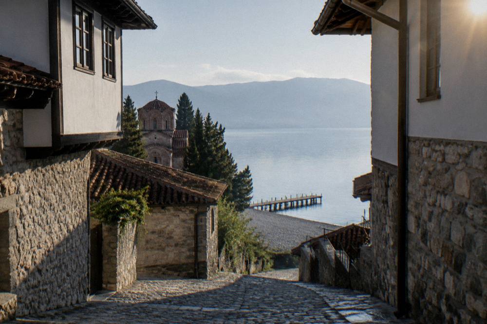
The logic is density. Ohrid's sight list, the Church of St John at Kaneo, St Sophia, Plaošnik, the Ancient Theatre and Samuel's Fortress, is concentrated in and above the old town, all of it walkable, and the itineraries on this site, from Ohrid in one day to Ohrid in two days, are built around that walkability. The southern shore is the opposite: a handful of beaches and one museum spread along a lake road, best consumed slowly.
Three patterns cover almost every trip length:
| Trip shape | How the southern shore fits |
|---|---|
| One night in Ohrid | Skip the shore loop; see the old town, and take a short boat ride from the port if time allows |
| Two to three nights | One full-day boat cruise to St Naum with a Bay of Bones stop, or one road afternoon to Peshtani and Gradiste plus a swim |
| Four nights or more | A dedicated beach day at Lagadin or Gradiste, plus the boat cruise, plus a separate day for Trpejca and Ljubaništa or the eastern shore |
For families, the shore is the easy sell: beaches with named swimming spots, shallow summer water and one child-friendly museum, all within a short drive of town, which is the shape of the considerations on the lake's family coverage. For couples, a sunset-oriented evening works better from the town side, where the walking tour options and the wine cruise in the picks below give the day a closer.
Two practical notes finish the planning picture. Emergency numbers in North Macedonia are ambulance 194, police 192 and roadside assistance 196. And the currency on this shore is the Macedonian denar: euros are commonly quoted for tours and transfers but are not legal tender, so beach cafes and museum desks price in denar, and the local costs in this article, the 1,200 den cruise fare, the 600 den child fare, the 850 to 950 MKD Skopje bus, stay in denar exactly as the sources give them, never converted.
What Else Sits Near Lagadin And Peshtani On The Lake?
East of Peshtani the shore continues to Trpejca and Ljubaništa, two more named swimming villages, and on to St Naum at the lake's southern tip, where the monastery stands by the Crn Drim springs and the Albanian border at Tushemisht lies about 4 km away; north-west at the other end of the lake, Struga sits where the Black Drim leaves Lake Ohrid, and Galicica National Park rises between the two lakes above the whole shore road.
That chain is what makes the southern shore more than a beach strip. A single day can run Ohrid to Peshtani by road, on to Trpejca, and end at St Naum, or do the same corridor by boat in the opposite order. The St Naum tour from Ohrid covers the far end in depth, and Struga makes a separate day to the west. The villages covered on this page are the near links, close enough to Ohrid for an evening drive back.
Galicica deserves its own line in any near-things list, because the park is the reason this shore exists in its present form: 22,750 hectares between the two lakes, open year-round, with heavy snow able to close the main park road in a typical January-to-March window. The park charges 250 MKD per vehicle with no per-passenger fee, and 100 MKD applies only to someone entering on foot from the Ohrid-side gate. The park's own site runs live cameras, useful for a snow check before any winter ridge drive.
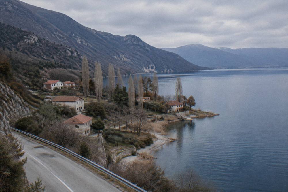
The UNESCO frame is the last piece of context. The "Natural and Cultural Heritage of the Ohrid Region" was inscribed in 1979 and 1980 and extended to the Albanian part of the lake in 2019, a mixed natural and cultural property of about 94,729 hectares. In July 2026 the World Heritage Committee decided not to place the property on the List of World Heritage in Danger, while asking for a joint report by 1 February 2029. Every shore covered on this page, Lagadin and Peshtani included, sits inside that property, which is the quiet argument for treating the beaches here with care.
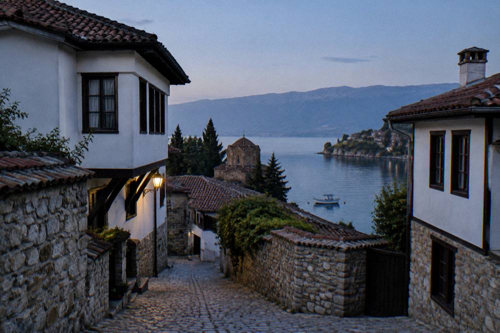
Common Questions About Lagadin And Peshtani
Are Lagadin and Peshtani walkable from Ohrid?
The old town of Ohrid climbs from the lake to the fortress on foot, and its lanes are pedestrian, but the southern-shore villages sit along the lake road east of town, reached by car, taxi or boat rather than on a town walk. Within each village, and along the beach at Gradiste, everything is on foot.
Can you swim at Lagadin and Peshtani?
Yes. Lake guides list Gradiste, Lagadin, Ljubaništa, Potpeši and Labino among the lake's popular swimming beaches, with pebble and mixed shores. Modelled lake-surface temperatures reach about 23 C in July and August, and 2026 bathing tests rated the lake's water Class I physico-chemically at most sampled points, with Grashnica beach near Ohrid the exception.
What is the Bay of Bones?
The Bay of Bones (Zaliv na koskite) is the Museum on Water at Gradiste near Peshtani, a reconstructed pile-dwelling settlement on the lake, run by the museum institute that also operates Robev Family House and the Icon Gallery in Ohrid. It closes on Mondays and runs a winter schedule from 1 October to 30 April and a summer schedule from 1 May to 30 September.
How do you get from Ohrid to Peshtani?
By road along the eastern shore, by taxi, or by boat: the full-day cruise from Ohrid port to St Naum, 7 hours from 1,200 den per adult and 600 den per child per the operator's listing, serves stops along this shore. Boat services run about May to October and reduce in winter, while the road stays open.
When is the best time to visit Lagadin and Peshtani?
July to September for swimming, with modelled water temperatures of about 23 to 24 C in July and August; May, June and September for everything else with cooler water and lighter traffic on the shore road. Peak season on the lake runs June to September, with August the high point.
Is Lagadin or Peshtani better as a base?
The sources here describe both as swimming spots rather than rating one against the other. Peshtani is the larger village and sits beside the Bay of Bones at Gradiste; Lagadin is the smaller, nearer-to-Ohrid option. First-time visitors usually base in Ohrid's old town and visit both as day stops.