Ohrid UNESCO World Heritage: What Is Protected
The Natural and Cultural Heritage of the Ohrid Region is one of only a handful of UNESCO mixed properties, inscribed twice, in 1979 for its nature and 1980 for its culture, and extended across the Albanian border in 2019.
Short answer
The UNESCO property covers about 94,729 hectares around Lake Ohrid, inscribed in 1979 and 1980 and extended to the Albanian part in 2019; it protects the lake's endemic wildlife, the Byzantine churches of the old town and the wider cultural landscape.
Ohrid, a lakeside town in North Macedonia on a freshwater mountain lake sitting at about 693 m above sea level, holds one of the most unusual distinctions in the UNESCO catalogue. The Ohrid Travel Guide covers the whole destination, but this page is about the listing itself: the Natural and Cultural Heritage of the Ohrid Region was inscribed twice, in 1979 for its natural values and in 1980 for its cultural ones, and the property was extended to include the Albanian part of the lake in 2019. That double inscription makes it a mixed property, judged outstanding both as a landscape and as a monument group, and the practical consequences reach everything from museum ticket lines to speed limits on the water.
What Does The Ohrid UNESCO Listing Actually Protect?
The listing protects about 94,729 hectares covering both the lake and its cultural landscape, inscribed by UNESCO in 1979 for natural values and in 1980 for cultural ones, then extended in 2019 to take in the Albanian side of the lake, so the protected area crosses an international border and is managed jointly by North Macedonia and Albania.
That figure, about 94,729 hectares, comes from UNESCO's own property page for the site. It is the number to hold onto when a guidebook talks loosely about "the old town" being World Heritage: the old town is the cultural heart of the inscription, but the property is far larger, taking in the open water of Lake Ohrid, the shoreline habitats and the monastic and village landscape around it. The 2019 extension means the boundary is not the national border. The town of Struga, the monastery of St Naum at the southern end of the lake, and the villages of the eastern shore all sit within or beside the protected region, and so does the Galicica ridge that separates Lake Ohrid from Lake Prespa.
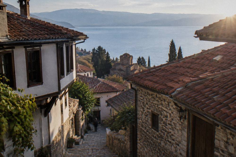
The double inscription matters for how the place is managed. A purely cultural listing would put the monuments first. A mixed listing puts the lake ecosystem on the same footing as the churches, which is why wastewater infrastructure, shoreline construction and boat traffic on the lake are all subjects of UNESCO reporting, not just planning matters for the municipality. Readers planning a first visit can get the town itself in focus through the things to do in Ohrid overview, or work out pacing with how many days in Ohrid suits their trip.
| Element of the property | Source | Source of the figure |
|---|---|---|
| Total area | About 94,729 hectares | UNESCO property page |
| Natural inscription | 1979 | UNESCO |
| Cultural inscription | 1980 | UNESCO |
| Extension to the Albanian part | 2019 | UNESCO |
| Property type | Mixed (natural and cultural) | UNESCO |
| States parties | North Macedonia and Albania | UNESCO |
Why Is Lake Ohrid Listed For Nature As Well As Culture?
UNESCO's citation records more than 200 endemic species in the lake, including 17 endemic fish, and describes the lake as having existed for about two to three million years, which is the basis of the natural inscription made in 1979 and the reason the open water, not just the shoreline, sits inside the protected area.
Those figures come from the UNESCO description of the property. Endemic means found here and nowhere else, and a count above 200 across fish, snails, algae and other groups is what earned the lake its natural listing three years before the cultural one followed. The lake's trout is among the fish tied to this ecosystem, and the same citation notes the lake's great age as about two to three million years. No superlative is needed beyond that: the numbers do the work.
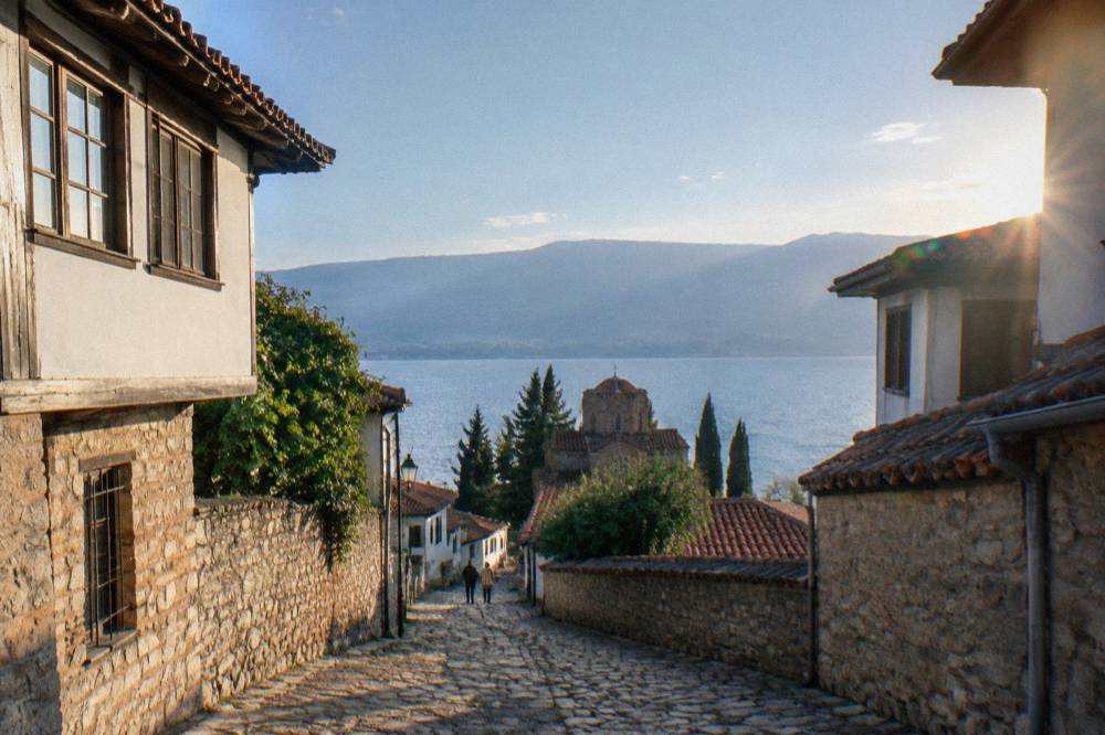
The lake sits at about 693 m above sea level by the daily hydrological gauge, and across the Galicica ridge Lake Prespa reads higher still, which is why the national park between the two lakes exists, and why hiking routes there feel alpine rather than lakeside. The water itself is the headline natural asset: 2026 bathing tests by the Institute of Public Health rated the lake's water Class I physico-chemically at almost every sampled point, with Grashnica beach the exception at Class III, and most microbiological samples returned "Excellent". Anyone planning to swim can read the detail on swimming in Lake Ohrid.
| Natural value cited by UNESCO | Figure | Notes |
|---|---|---|
| Endemic species in the lake | Over 200 | Fish, molluscs and other groups |
| Endemic fish species | 17 | Part of the 200+ total |
| Age of the lake | About two to three million years | UNESCO description |
| Lake Ohrid water level | About 693 m above sea level | Daily hydrological gauge |
| Galicica National Park area | 22,750 ha | Between Lake Ohrid and Lake Prespa |
Which Ohrid Churches And Monuments Are Inside The Protected Zone?
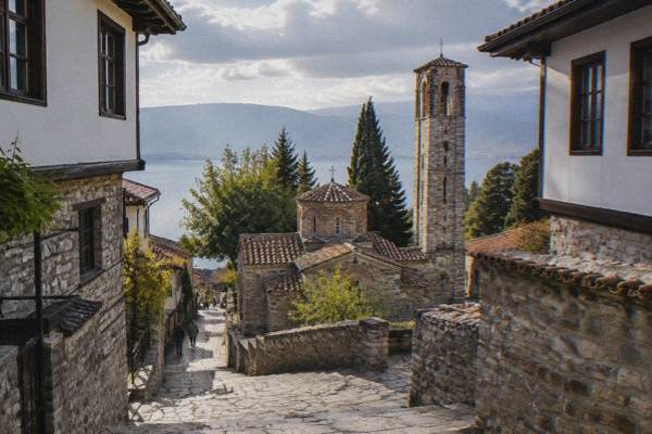
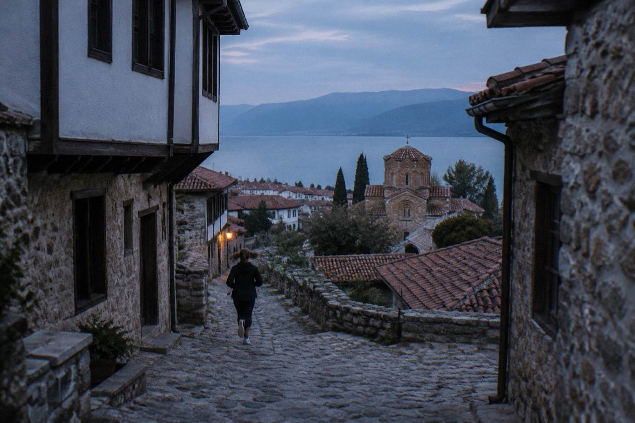
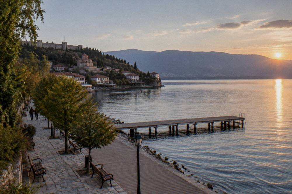
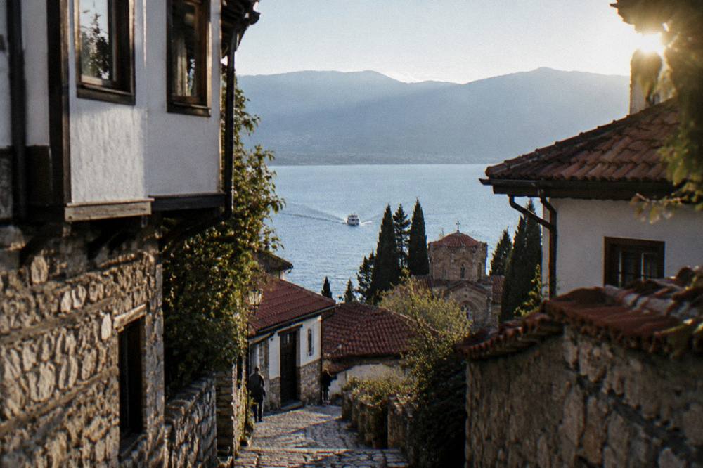
The cultural inscription covers the Byzantine monuments of Ohrid's old town, and UNESCO's citation records more than 800 Byzantine-style icons from the 11th to the end of the 14th century held in the town, along with the early Slav monastic site at Plaosnik, the Ancient Theatre, the fortress ridge and the chain of churches that runs down to the lake shore at St John at Kaneo.
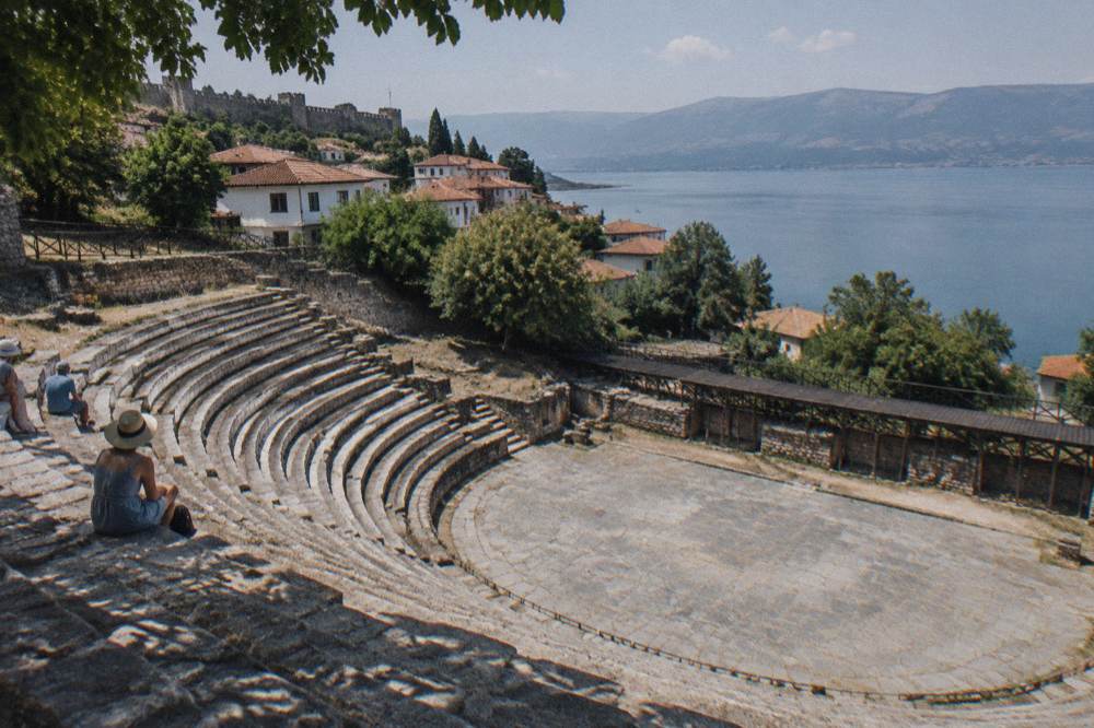
The icon count is the figure UNESCO itself prints, and the collection is the reason the Icon Gallery at the Perivleptos complex is more than a local museum: it is one of the holdings the cultural inscription rests on. The Ancient Theatre, excavated from 1935 and dated to the end of the 3rd or start of the 2nd century BC, had a capacity that rose to about 5,000 after its upper seating was added, and it still serves as an open-air venue for the Ohrid Summer Festival, which opened its 66th edition there on 12 July 2026. The fortress above, Samuel's Fortress, anchors the ridge, with the lanes of the old town stepping down from it to the water.
Several of the key monuments are run by the NI Institute and Museum Ohrid, and its ticket system covers them: Robev Family House in the old town, the Bay of Bones (Museum on Water) at Peshtani, and the Icon Gallery. The institute's own site lists the foreign adult ticket at 150 MKD, domestic at 120 MKD, with a reported child and student rate of 60 MKD. Its sites keep a winter schedule from 1 October to 30 April and a summer schedule from 1 May to 30 September, and the museum sites are closed on Mondays.
| Museum institute site | Location | Foreign / domestic ticket | Closed |
|---|---|---|---|
| Robev Family House | Tsar Samoil St 62, old town | 150 / 120 MKD | Monday |
| Bay of Bones (Museum on Water) | Gradishte, Peshtani | 150 / 120 MKD | Monday |
| Icon Gallery | Perivleptos complex, Klimentov Univerzitet St | 150 / 120 MKD | Monday |
The churches outside the museum system, St John at Kaneo, St Sophia and Plaosnik, are each reported at about 150 MKD entry by secondary sources, a figure the museum institute's own pages do not confirm, so treat those amounts as approximate and check at the door. The monastery of St Naum at the southern end of the lake charges 150 MKD per person according to a cruise operator's published list, and a rowboat ride through the Crn Drim springs there costs about 5 EUR. A full-day boat cruise from Ohrid port to St Naum with Boat Armada runs 7 hours at 1,200 MKD for an adult and 600 MKD for a child; the Lake Ohrid boats and ferries page has the seasonal detail.
Seeing the whole protected zone in one outing is the appeal of a guided day: a tour that covers the old town's monuments, the lake shore and the southern monastery takes the scheduling work off the visitor, and the free-cancellation terms on the listing make it a low-commitment addition to a trip plan.
What Did The World Heritage Committee Decide About Ohrid In 2026?
That is a decision with history behind it. In 2025 the Committee had found that the conditions for a Danger List inscription were met, and the 2026 session was widely watched for that reason. The outcome keeps the property off the Danger List while keeping pressure on: the decision addresses illegal construction and urbanisation around the lake, incomplete strategic environmental assessments, transboundary governance between North Macedonia and Albania, wastewater management and the suspension of new developments pending assessment. For a visitor, nothing about the listing changed in July 2026. The property remains inscribed, the monuments remain open, and the debates are about construction and infrastructure rather than access.
The practical echoes reach the town in small ways. The lake's collector sewer system, which serves Ohrid and Struga and treats at Vranishta, still has unconnected properties and known defects, and 2026 budget lines fund pump and generator modernisation projects. The 2026 water tests cited above are the visible output of that scrutiny. None of this affects a walk down to Kaneo; all of it is why the lake's water quality is monitored as closely as it is.
How Much Does It Cost To See The UNESCO Sights In Ohrid?
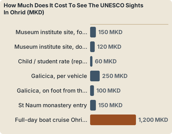
A foreign adult pays 150 MKD at each museum institute site in Ohrid, so Robev Family House, the Bay of Bones and the Icon Gallery are each bought on the same ticket tariff, Galicica National Park charges 250 MKD per vehicle with no per-passenger fee, or 100 MKD for someone entering on foot at the Ohrid-side gate, and the full-day boat cruise to St Naum lists from 1,200 MKD per adult.
Those are the published figures. The institute also lists a domestic rate of 120 MKD and a reported 60 MKD child and student rate. The Bay of Bones sits at Gradishte near Peshtani, on the lake road south of town, and the cruise operators call at it on the way to St Naum; its entrance is listed at 150 MKD per person on a cruise operator's own "not included" list, matching the institute's ticket. Galicica National Park, North Macedonia's second national park, established in 1958, covers 22,750 ha between Lake Ohrid and Lake Prespa with the Magaro peak at 2,254 m, and is open year-round, though heavy snow can close the main road, typically from January to March.
| Item | Price | Who publishes it |
|---|---|---|
| Museum institute site, foreign adult | 150 MKD | muzejohrid.mk |
| Museum institute site, domestic adult | 120 MKD | muzejohrid.mk |
| Child / student rate (reported) | 60 MKD | Reported on the institute's page |
| Galicica, per vehicle | 250 MKD | Park guidance |
| Galicica, on foot from the Ohrid-side gate | 100 MKD | Park guidance |
| St Naum monastery entry | 150 MKD | Cruise operator's list |
| Rowboat at the Crn Drim springs | About 5 EUR | Cruise operator's list |
| Full-day boat cruise Ohrid to St Naum | From 1,200 MKD adult / 600 MKD child | Boat Armada |
Budgeting for the whole trip, not just the monuments, is easier with the cost and budget for Ohrid breakdown, and the currency mechanics, a denar pegged in practice to the euro with euros not legal tender, are explained on the denar and money page. Pay museum tickets in denars; the boats and some tours quote in either.
When Is The Best Time Of Year To Visit The Ohrid World Heritage Site?
July and August are the warmest months, with modelled ERA5 climate normals for 1991 to 2020 showing mean daily highs of 27.1 C and 27.6 C and the lowest monthly rainfall, 34.7 mm and 32.9 mm, while modelled lake surface temperatures peak in August at about 23.5 C, and the museum sites run their longer summer schedule from 1 May to 30 September.
The climate figures are modelled normals from the ERA5 reanalysis for a grid cell over Ohrid, not a station record, and they should be read as planning ranges. Winter is cold rather than severe: January's mean daily high is 5.0 C and its mean low is -0.8 C, with 76.5 mm of rain. December carries 92.6 mm of rain and November 90.4 mm, against August's 32.9 mm. If the point of the trip is the water, the modelled surface temperature reaches about 22.9 C in July and 23.5 C in August, sits around 19.7 C in September by the same modelled series, and drops to about 14.7 C in October; the measured multi-year October mean from the hydrological service is 14.3 C. The best time to visit Ohrid and Ohrid weather pages carry the month-by-month detail.
| Month | Mean high C | Mean low C | Rain mm |
|---|---|---|---|
| Jan | 5.0 | -0.8 | 76.5 |
| Mar | 10.0 | 2.5 | 80.5 |
| May | 19.5 | 10.8 | 70.8 |
| Jul | 27.1 | 18.3 | 34.7 |
| Aug | 27.6 | 19.0 | 32.9 |
| Oct | 17.4 | 10.3 | 76.0 |
| Dec | 6.2 | 0.9 | 92.6 |
Modelled monthly lake surface temperatures, from an aggregator series rather than a station, run about 4.6 C in January, 10.5 C in April, 19.4 to 22.5 C in June, and about 6.0 C in December. Boats to St Naum generally run from about May to October with a reduced winter schedule, and the road to St Naum stays open when the boats stop. Festival dates anchor the cultural calendar: the Ohrid Summer Festival opened 12 July 2026 and runs by tradition to 20 August, the Balkan Festival of Folk Songs and Dances held its 65th edition from 3 to 6 July 2026, the Struga Poetry Evenings ran 24 to 29 June 2026 in Struga, and the Ohrid Water Festival in August 2026 included the 25 km swimming marathon from St Naum to Ohrid harbour on 22 August and a separate 33 km stand-up-paddle marathon around the lake on 26 August.
Can You See The Ohrid UNESCO Sites On A Day Trip From Skopje Or Tirana?
Yes, and the listings are explicit about where each product starts: the Ohrid UNESCO Heritage full-day guided tour departs from Skopje, roughly 170 km away by road, while several Ohrid and St Naum day tours depart from Tirana or Durres, so the decision is really which base city you are already sleeping in, not which town the sights are in.
The bus from Skopje takes about 3 hours and costs 850 to 950 MKD one way; driving is about 172 km and 2.5 hours plus about 140 MKD in motorway tolls, and there is no passenger train and no domestic flight. A day trip from Skopje means an early start, a full loop through the old town's monuments, and a return at night, which is exactly what the guided product is built around: Check availability for the tour's own listing for dates and inclusions. From Tirana, minibuses run several times a day, take 3 to 3.5 hours including the border crossing at Qafe Thane, and cost about 15 to 20 EUR, with the routes covered on the Tirana to Ohrid and Skopje to Ohrid pages.
For anyone staying in Ohrid itself, the calculus reverses: the town rewards slow walking, and a shorter guided walk of the old town fits between a morning at the fortress ridge and an afternoon on the water. That is the gap the small-group old town walks fill.
Prefer to explore the old town at your own pace? Book a self-guided audio tour here.
What Rules Protect The Lake And The Old Town Today?
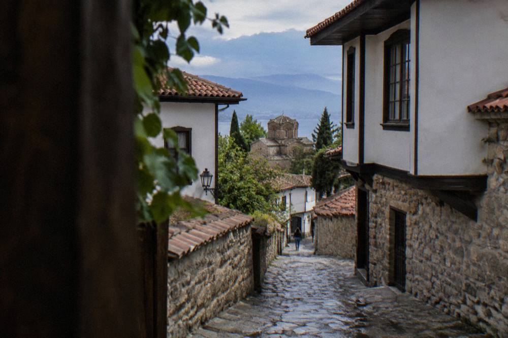
A Government decision of 2 June 2026 bans jet skis on Lake Ohrid from 1 July to 31 August between 11:00 and 19:00, bans boat traffic at night from 3 June to 31 August between 21:00 and 05:00 and through September between 20:00 and 06:00, and from summer 2026 the old-town streets Ilindenska, Kosta Abrash and Car Samoil are reserved for resident parking, with clamping reported for non-residents.
Those three measures, published by the Ministry of Transport and by local news respectively, are dated 2026 rules, written with their year, not permanent law. The navigation limits exist for swimmer safety in the peak months; the parking regime exists because the old-town lanes are narrow and on foot. For a visitor the consequences are simple: expect boat schedules to shape around the daytime windows in high summer, and do not plan to park on the old-town streets listed above.
The museum side of protection is quieter but concrete: the institute's sites close on Mondays and shorten their hours in winter, from 1 October to 30 April, so a Monday arrival in November finds Robev Family House, the Bay of Bones and the Icon Gallery shut. Samuel's Fortress, on the other hand, has a municipal revitalisation plan with a summer stage and illumination budgeted at over 11 million denars, which tells you the ridge is being invested in, not closed. The neighbourhood pages for the old town and the wider set of Ohrid churches cover how the pieces sit together on the ground.
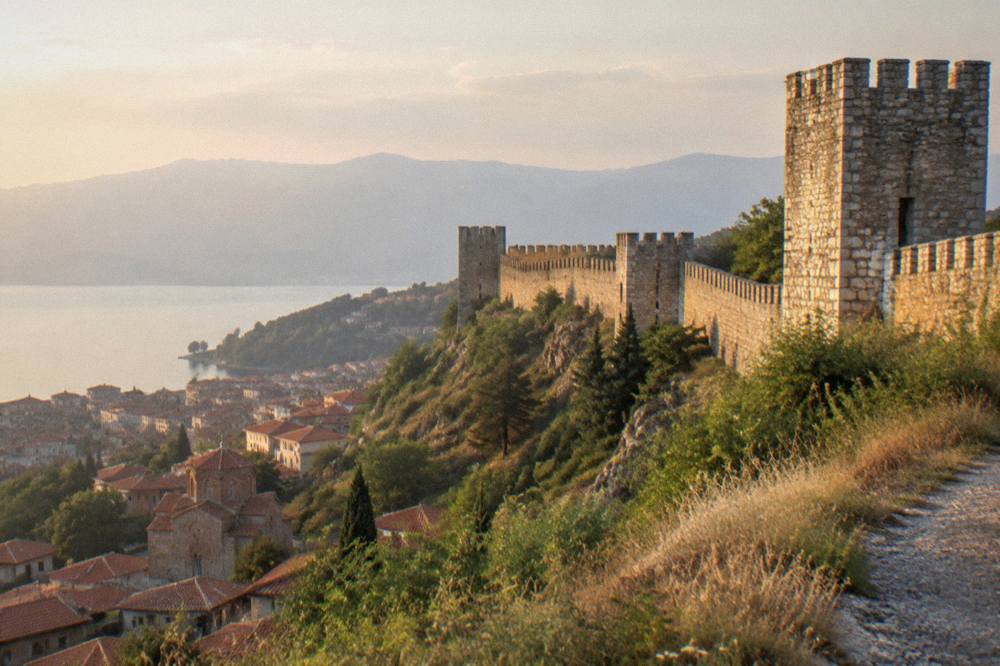
The listing, in the end, is the reason this small town has a museum institute, a monitored lake and an international reporting schedule at all. Walk from the fortress down to St John at Kaneo and every step passes through a property boundary that is bigger than the view.
Common Questions About The Ohrid UNESCO World Heritage Site
On 24 July 2026 the World Heritage Committee decided not to inscribe the property on the List of World Heritage in Danger; its decision 48 COM 7B.62 asks North Macedonia and Albania for a joint report by 1 February 2029 instead.
When was the Ohrid region inscribed by UNESCO?
Twice: in 1979 for its natural values and in 1980 for its cultural ones, making it a mixed property. It was extended to include the Albanian part of the lake in 2019.
How big is the Ohrid UNESCO property?
About 94,729 hectares, covering the lake, its shoreline and the cultural landscape around it, jointly managed by North Macedonia and Albania.
Which Ohrid sights are included in the listing?
The old town's Byzantine monuments, among them St Sophia, Plaosnik, St John at Kaneo, the Perivleptos complex with its Icon Gallery, the Ancient Theatre and Samuel's Fortress, plus the wider lake landscape including St Naum and the Bay of Bones.
How much do the UNESCO museums in Ohrid cost?
The museum institute charges 150 MKD for foreign adults and 120 MKD for domestic, with a reported 60 MKD child and student rate, at Robev Family House, the Bay of Bones and the Icon Gallery. All three close on Mondays.
Why is Lake Ohrid listed for nature as well as culture?
UNESCO records more than 200 endemic species in the lake, including 17 endemic fish, and describes the lake as having existed for about two to three million years, which earned the natural inscription in 1979, three years before the cultural one.